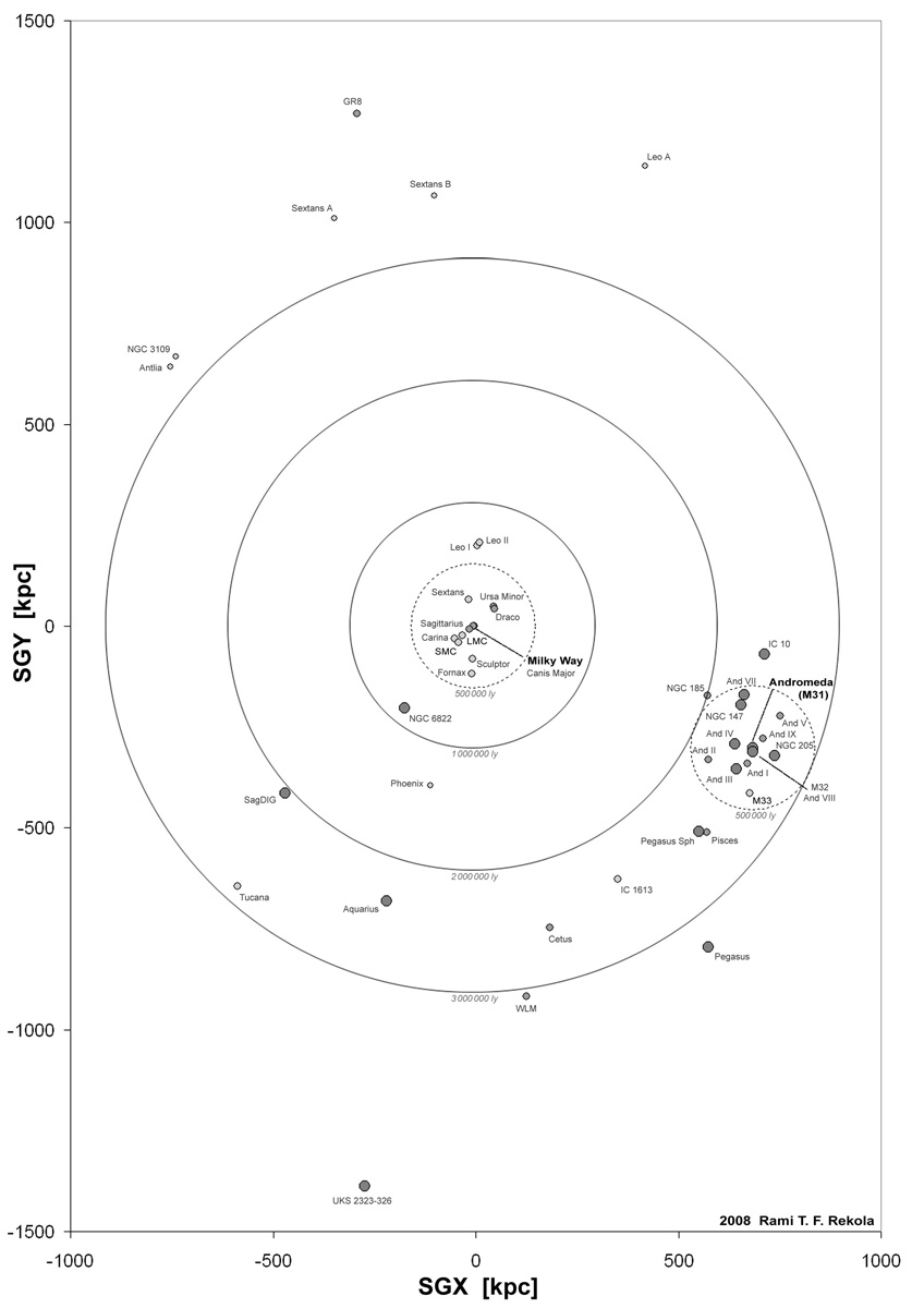
Map of the Local Group of galaxies

This is the map of the Local Group of Galaxies, shown in supergalactic cartesian coordinate system. The horizontal axis is SGX and vertical axis SGY, which means the image depicts the supergalactic plane. Units are in kiloparsecs.
The third dimension (SGZ) is depicted by the size and colour of the galaxies. The smaller and lighter in colour the galaxy is the further away it is. Therefore the largest and darkest circles are the ones closest to the viewer, who is above the supergalactic plane. True sizes of galaxies are so small in this scale that most galaxies would not be visible at all in this image.
The image shows also three concentric rings centred on the origin of the supergalactic coordinate system (i.e. the solar system). The rings indicate various distances from the origin. There is another similar, smaller ring centred on the Andromeda Galaxy.
If you compare this image with the true 3D image, you will see that the true image shows the Local Group from a direction that is to the upper left in this image.
Click the image to see it larger.
Taustan kuva:
Background image:
ESO


